


Suburban forest canopy monitoring has become an essential part of understanding how our towns and cities manage their living infrastructure. Across Great Britain, local authorities, independent environmental groups, and dedicated community volunteers are looking closely at how trees are distributed across residential streets, parks, and private gardens. This work involves much more than simply counting individual trunks; it requires a detailed view of the leafy overhead layer that provides shade, supports urban wildlife, and filters the air. When communities understand the actual extent of their local greenery, they are better equipped to advocate for sensible planting initiatives. Much like air quality mapping helps authorities identify pollution hotspots, detailed tree tracking reveals where neighbourhoods might be lacking adequate environmental protection. Clear data collection ensures that discussions around local greenery are grounded in measurable observations rather than vague assumptions.
What Is Suburban Forest Canopy Monitoring?
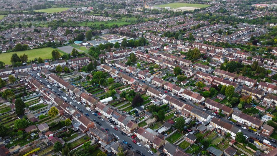
Suburban forest canopy monitoring is the systematic measurement and analysis of the layer of leaves, branches, and stems of trees that cover the ground when viewed from above in residential and peri-urban areas. This scientific practice combines advanced remote sensing technology, geographical data software, and ground-level ecological surveys to track changes in urban foliage over time. By utilizing these multi-layered approaches, environmental scientists can distinguish between dense, multi-layered woodlands and the fragmented, highly managed tree cover typical of British suburbs. Monitoring helps municipalities observe how individual garden trees, roadside plantings, and small public greenspaces contribute to the broader urban forest ecosystem.
To understand the health of these suburban green networks, practitioners rely on a combination of high-resolution aerial photography and specialized geographic information systems, often informed by resources provided by agencies like the Ordnance Survey. Aerial imagery allows analysts to capture seasonal shifts in foliage density across entire municipal districts without needing to survey every single street manually. However, aerial views alone often miss crucial details happening beneath the leaves, which is why local authorities pair these overhead images with detailed street-tree inventories. These inventories record species diversity, tree health, and trunk diameters, giving planners a granular look at the immediate neighbourhood environment. Furthermore, citizen science initiatives play a vital role by ground-truthing satellite data through direct observation, helping to bridge the gap between high-altitude computer models and boots-on-the-ground reality.
Methodologies and Practical Applications on the Ground
Gathering accurate environmental information requires clear distinctions between different types of vegetation, ensuring that scrubland or low bushes are not mistakenly categorized as mature timber. Tree cover mapping specifically isolates woody perennial plants that reach a certain height threshold, separating them clearly from open grasslands, agricultural fields, or dense natural woodlands. When organizations look at data published by groups like the Woodland Trust, they often find that suburban tree populations face unique pressures from property development, utility maintenance, and climate stress. This makes precise tracking essential for identifying neighbourhood disparities where canopy coverage might be heavily concentrated in affluent areas while sparse in others. Local authorities frequently consult guidance from the Tree Council to ensure their management frameworks reflect current best practices in urban forestry management.
- Aerial Imagery Analysis: Utilizing high-resolution flyovers to measure overhead green cover across residential zones and public parks.
- Geographic Information Systems: Integrating multiple spatial layers to map tree locations alongside housing density and infrastructure networks.
- Street Tree Inventories: Maintaining detailed local council databases that record the species, age, and physical condition of public highway trees.
- Citizen Observations: Engaging local volunteers to report canopy damage, disease symptoms, and newly planted saplings in their immediate areas.
It is important to recognize that mapping the landscape is only a diagnostic tool and does not automatically alter planning decisions or prevent habitat loss. Having access to precise canopy percentages does not halt development pressures, nor does it guarantee that local planning committees will prioritize green infrastructure over other economic interests. Instead, these detailed reports provide a foundational evidence base that community groups can use during public consultations to highlight local needs. As noted in various regional council reports, transparent data empowers everyday residents to ask informed questions about local tree preservation orders and replacement planting mandates.
Community Engagement and Local Implementation
Local involvement remains the beating heart of successful urban forestry initiatives across the country, transforming abstract remote sensing data into tangible neighborhood action. When residents participate in mapping exercises, they develop a deeper connection to their surrounding landscape and become active stewards of their local environment. Such grassroots involvement often leads to community-led planting days, careful monitoring of newly established saplings during dry summer months, and prompt reporting of suspected tree diseases to local authorities. Similar to how citizen science initiatives have transformed water and air testing, public participation in forestry projects ensures broader oversight and continuous data collection that municipal teams alone could never achieve.
When you spend a Saturday morning measuring the trunk diameter of the old lime tree on the corner, you start noticing how much cooler the street feels compared to the paved car park nearby.
Ultimately, keeping an eye on our suburban greenery requires sustained cooperation between local government officers, academic researchers, and residents who care about their immediate surroundings. By combining high-tech geospatial analysis with old-fashioned community vigilance, towns and cities can better protect the leafy environments that make residential areas liveable. As these monitoring practices evolve and become more accessible, communities will be better prepared to safeguard their urban forests against future environmental pressures. Every mapped tree and every recorded canopy gap brings us one step closer to healthier, more resilient neighbourhoods across Britain.
References:
Ordnance Survey. (2023) Geospatial data standards for urban environments. Government Geoportal.
Tree Council. (2022) Managing and monitoring local tree stocks: A guide for community groups. National Tree Publications.
Woodland Trust. (2023) State of the UK’s woods and trees: Urban canopy analysis. Woodland Trust Research Reports.